One Island, Many Names
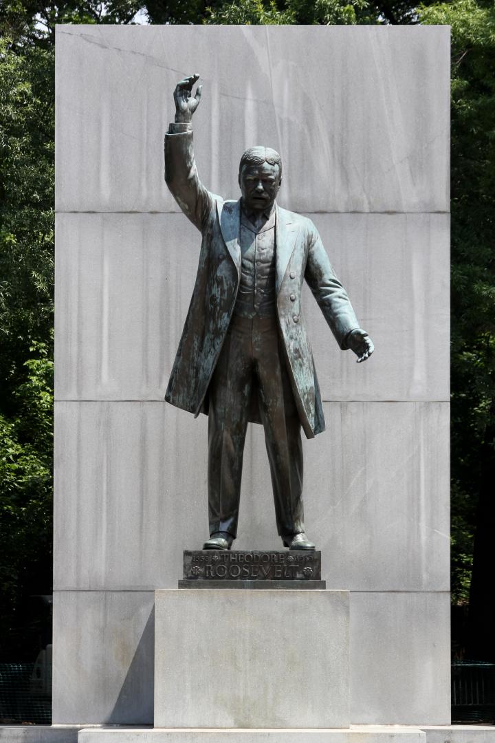
Today, the 80-acre island serves as a national monument to President Theodore Roosevelt, but it has known many names over the years.
Today, the 80 acre island, strategically located between Rosslyn and Georgetown, serves as a national monument to President Theodore Roosevelt, but it has known many names over the years.
When Captain John Smith explored the Potomac in 1608, he included the island and nearby Native American villages on his map of Virginia. One of the names associated with the island was "Analostan." The name refers to the seventeenth-century Necostin Indian tribe that once inhabited the area.
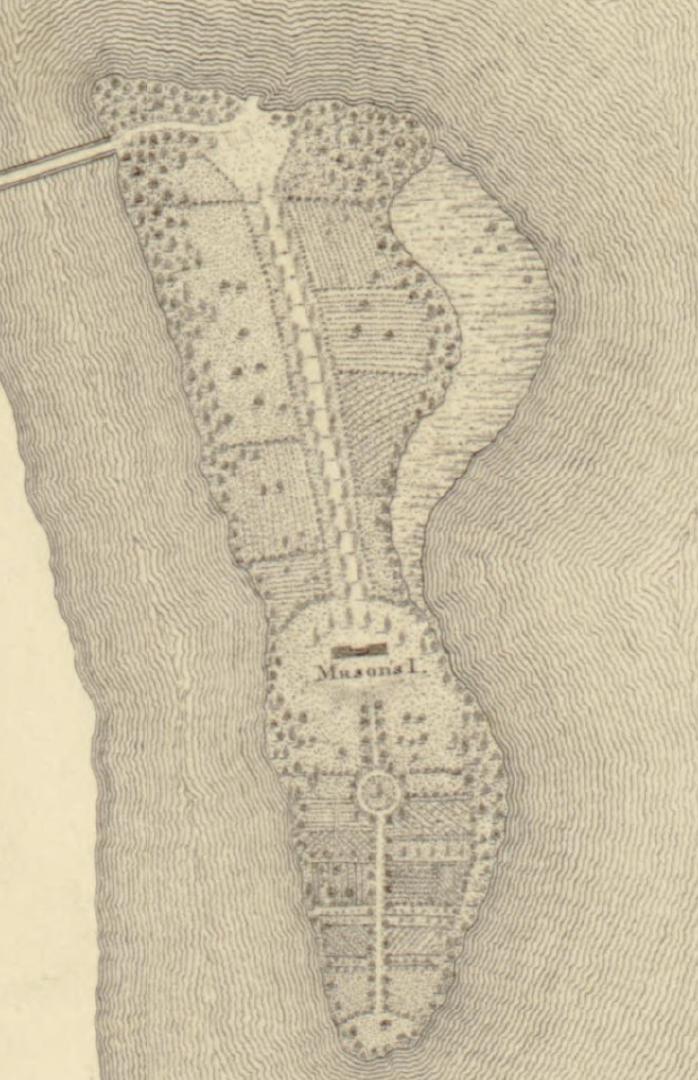
In 1724, the island was purchased by the family of Founding Father and delegate to the U.S. Constitutional Convention George Mason. It was part of a two thousand acre land grant that included today's Clarendon. Upon George Mason's death on October 7, 1792, his son John inherited the island.
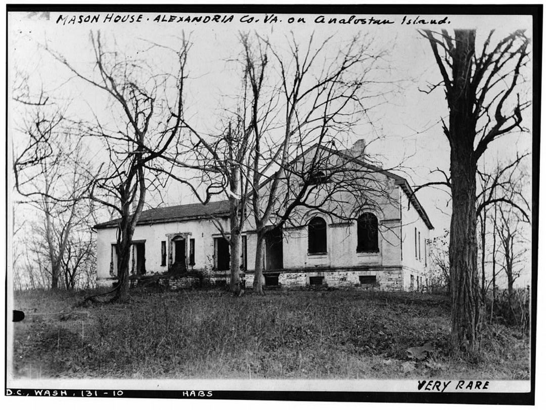
In 1796 John Mason constructed a large house on the highest point of the island where it commanded a view of the new capital city and the President's mansion, the Capitol, and the other buildings as they arose. Mason hosted many lavish parties, and the property was well known among Washington's elite, including George Washington and Thomas Jefferson.
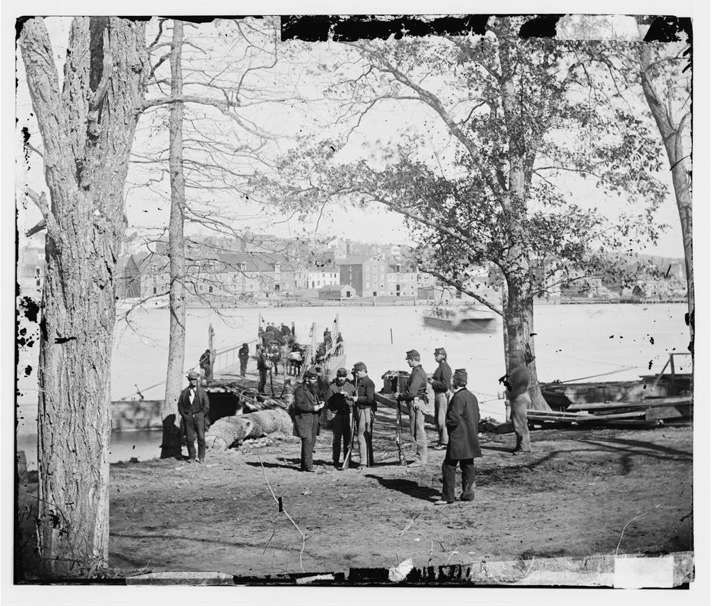
A ferry crossed the Potomac from John Mason's Virginia land to Georgetown adjacent to Analostan Island. The ferry had been at that site since 1748, enabling commerce from Alexandria and Georgetown.
Due to financial losses, John Mason was forced to sell his beloved Analostan Island in 1842. For the next several decades the property exchanged hands several times.
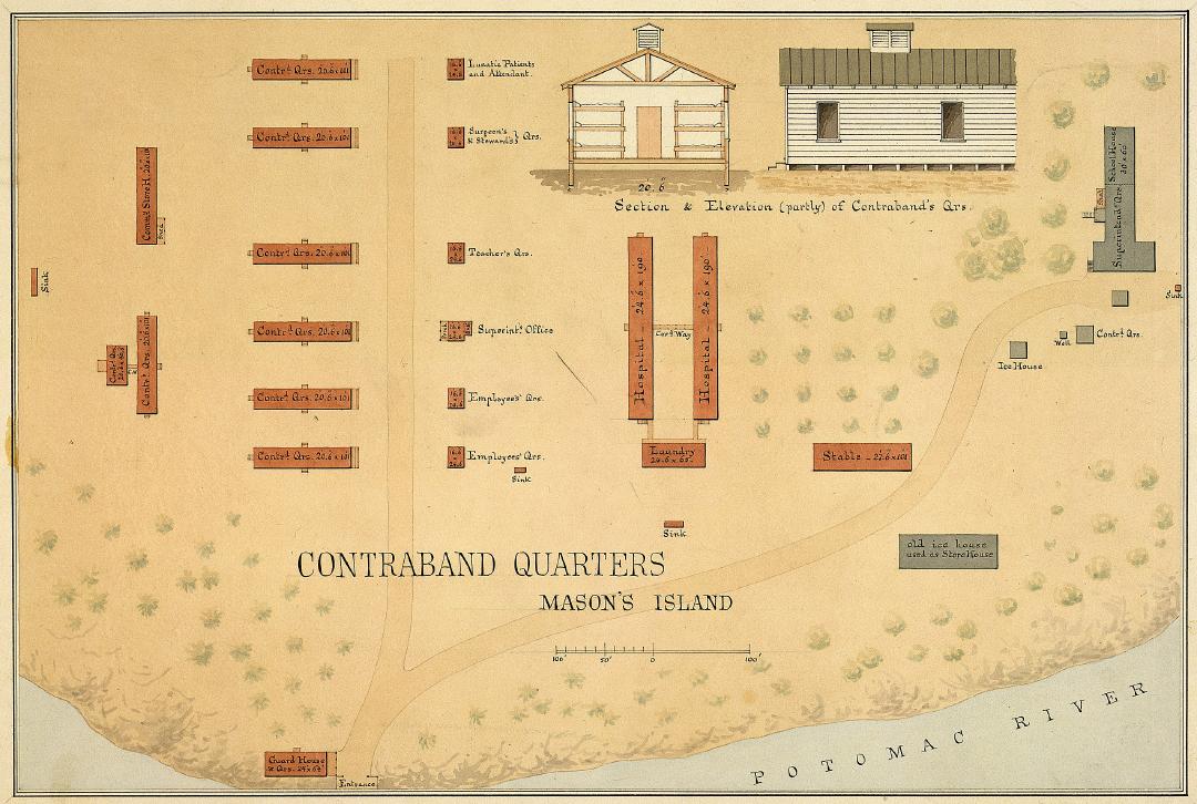
At the start of the Civil War in 1861, Union forces took control of the island and ferry. The property was now called Mason's Island, and in 1863, it became a U.S. Army training facility called Camp Greene.
When African Americans were finally allowed to join the U.S. Army, the 1st United States Colored Infantry used the island to train its soldiers. From 1864 to 1865, the camp also was home to as many as 1,200 formerly enslaved people, first under the authority of the U.S. Army and later, the Freedmen's Bureau.
Following the Civil War, the land remained uninhabited and was eventually purchased in 1931 by the Theodore Roosevelt Memorial Association to erect a memorial honoring Roosevelt. While Congress authorized the memorial on May 21, 1932, there were no funds for construction for almost three decades.
Funds were finally designated by Congress in 1960. As with all historic areas administered by the National Park Service, the national memorial is listed on the National Register of Historic Places; the listing first appeared on October 15, 1966.
The memorial was dedicated on October 27, 1967. Designed by Eric Gugler, the memorial includes a 17-foot (5.2 m) statue by sculptor Paul Manship, four large stone monoliths with some of Roosevelt's more famous quotations, and two large fountains.
Images