Alexandria Canal
The Alexandria Canal was a historic waterway that connected Alexandria and Georgetown in the District of Columbia.
The Alexandria Canal was a historic waterway connecting Alexandria to Georgetown in the District of Columbia. The canal played a crucial role in the transportation and economic history of the region. Its construction and operation had a considerable impact on the area.
In 1830, local merchants proposed the idea of connecting Alexandria to Georgetown through a canal. Alexandria was a part of the federal District of Columbia at that time. The Congress recognized the potential benefits of joining Alexandria to the Chesapeake and Ohio Canal (C&O Canal) and granted a charter to the Alexandria Canal Company. This marked the beginning of a substantial infrastructure project.
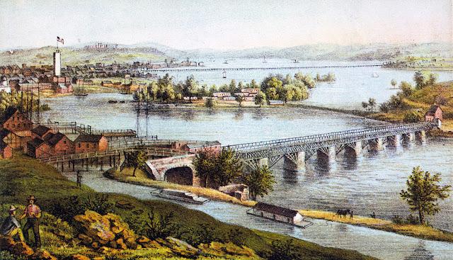
Construction of the canal began in 1833 and was completed in 1843. As a part of the same project, the Aqueduct Bridge was built, which started in 1833 and was completed in 1843. The Aqueduct Bridge was crucial in allowing canal boats from the C&O Canal to cross the Potomac River without lowering the river level. These boats then continued their journeys downstream along a canal on the southwest side of the Potomac and made their way to Alexandria's seaport.
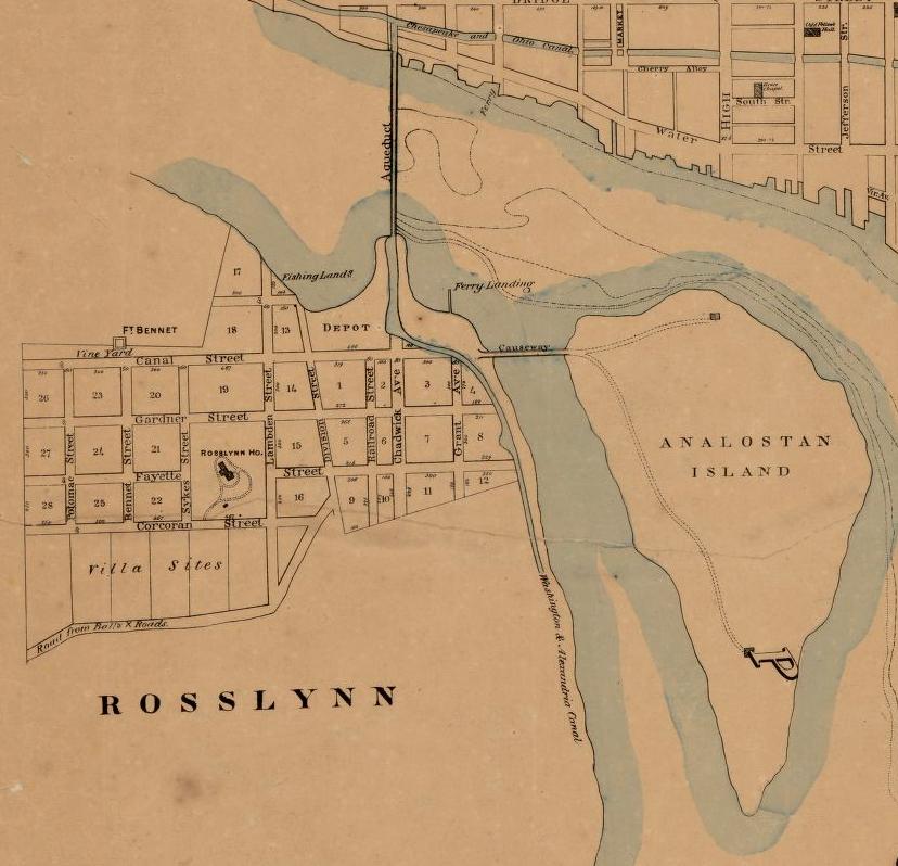
The Alexandria Canal ran southward for seven miles, covering present-day Arlington County and the City of Alexandria, Virginia. To help the boats move through the elevation change, four locks were built between Washington Street and the Potomac River north of Alexandria. These locks enabled the ships to drop 38 feet along the canal. Finally, the canal ended at a Tidal Basin, Pool No. 1, and a Tidal Lock, designated as Lift Lock No. 1, at the northern tip of Old Town Alexandria.
Despite its early importance for trade and commerce in the region, the Alexandria Canal was abandoned in 1886. Ten years later, in 1896, a significant development occurred with construction of an electric trolley line. This line was built on the canal's towpath and closely followed its route on the western side, especially in Arlington. Today, South Eads Street in Arlington closely approximates the path of the historic canal in this area.
In 1896, the Washington Southern Railway established a rail line that connected the Long Bridge's southern end to the Aqueduct Bridge's southern end. This railway line went through the area between Arlington National Cemetery and the Potomac River, close to the present location of The Pentagon. The railway line was built within the grade of the former canal and later turned into the Rosslyn Connecting Railroad in 1904, owned by the Pennsylvania Railroad through a subsidiary called the Philadelphia, Baltimore, and Washington Railroad (PB&W).
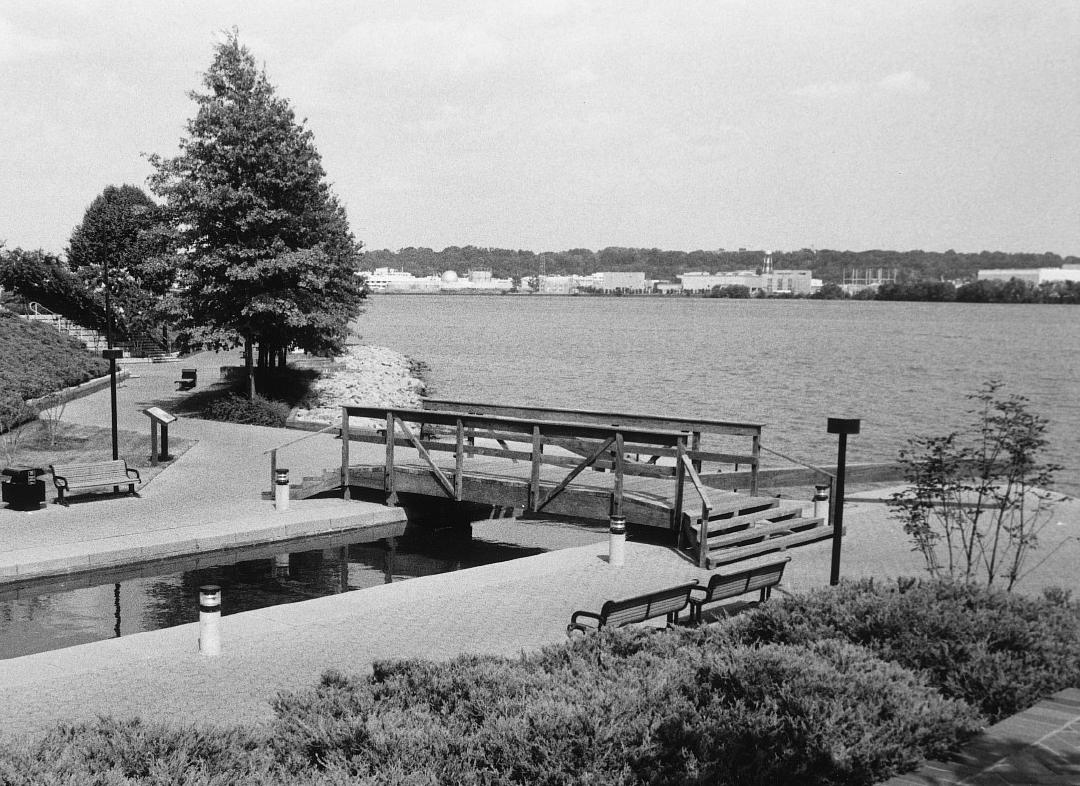
After the Key Bridge was completed in 1923, the original structure of the Aqueduct Bridge was torn down. In the 1980s, archaeologists from Alexandria City worked with the nearby Trans-Potomac Canal Center developer to excavate the area. They found the Tidal Basin and Lock of the Alexandria Canal, which were then carefully reconstructed. Unfortunately, most of the canal's remains, such as the abutments of the Aqueduct Bridge in Georgetown and Rosslyn, as well as a pier of the bridge in the Potomac River upstream of the Key Bridge, no longer exist or are buried underground.
Images