Howson Patent
He described his new land acquisition as being "upon the freshes of Potowmack River above the dividing branches of the same."
On October 21, 1669, The first land grant patent was issued for land that would become Arlington County. This patent was for a 6,000-acre tract of land granted to Robert Howson by Sir William Berkeley, Governor of the Colony of Virginia.
Howson was a Welsh sea captain who had already acquired land in what is now Westmoreland County. He described his new land acquisition as "upon the freshes of Potowmack River above the dividing branches of the same."
A month later, on November 13, 1669, Howson transferred his patent to the surveyor, John Alexander, for 6,000 pounds of tobacco. According to the official document, Howson carried 120 persons aboard his ship. The Howson Patent was granted under the headright system, entitling a person to 50 acres for each person transported to colonial Virginia. Howson was eligible to receive 50 acres multiplied by 120 persons, which equates to 6,000 acres of land. So, he earned the land based on the number of people he transported to settle in northern Virginia.
No copy of the original land survey for the Howson Patent has survived, although several other surveys made later are on record due to several litigations concerning the property lines.
The Howson Patent was surveyed on February 26, 1693, by Theodorick Bland, surveyor of Stafford County. No original copy survives, but the record of a suit in the Fairfax County Court contains a recital produced before Daniel Jennings, Surveyor of Fairfax, in 1746. This survey plat appears in the Fairfax County Record of Surveys: 1742-1856, pages 11 -12.
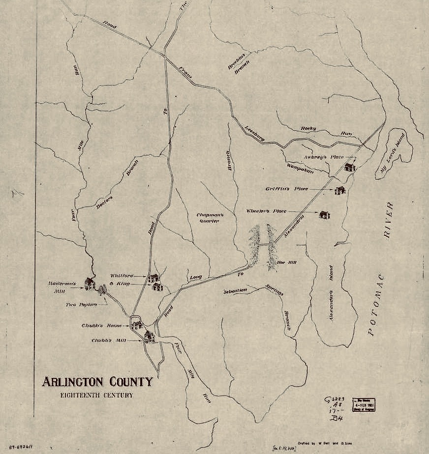
Over the years, the original Howson Patent has been subdivided into smaller parcels and individual lots. Arlington National Cemetery and Fort Myer occupy a small portion of the original Howson Patent. One of the original lines of the grant continues to exist as a dominant feature on the Arlington County landscape. This is the patent's northern boundary, which runs approximately east-west from Theodore Roosevelt Island (known as My Lord's Island in 1669) to Arlington Blvd. (U.S. Highway 50) on the west side of the Fort Myer reservation boundary. The back line or west boundary of the north-south line of the original Howson Patent can be seen on the 1900 Howell and Taylor Map of Alexandria County, Virginia, showing land ownership boundaries.
Images